reading coastlines with leslie geddes
november 18, 2024, 5:30–7:00 PM
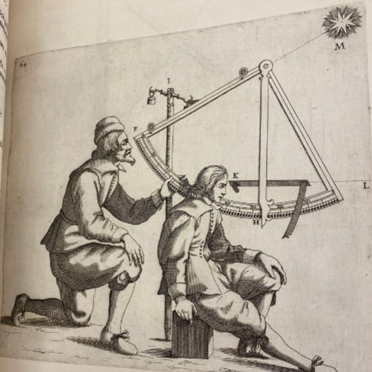
In this Research and Academic Program lecture, Leslie Geddes (Tulane University / Clark Fellow) asks: How did early modern cartographers teach others how to see coastlines and read their contours in maps? Was there a specifically hydrological way of seeing? This talk makes Italian hydrography distinct by focusing on how early modern printed atlases shed light on the vast conceptual gulf between articulating known terrain versus cartographic imaginings of remote seas. More than collections of maps, atlases such as Robert Dudley’s Arcano del Mare (“The Secrets of the Sea”) (Florence, 1646–47) incorporate volvelles and other paper instruments built into the book for the reader’s experimentation and delectation. As manipulable objects, atlases served as a training ground for readers to learn principles of navigation and to read maps effectively. Atlases set the parameters for apprehending cartographic knowledge. The implications are nothing short of the limits of firsthand knowledge of the aquatic environment and its cartographic representation.
Presented in person in the Clark auditorium. A 5 pm reception in the Manton Research Center reading room precedes the event.
Image: Robert Dudley, Dell’arcano del mare (Francesco Onofri), vol. 3, pl. 64, 1647, engraving on paper. The Huntington Library. Photo: Leslie Geddes.