ABOUT THE EXHIBITION
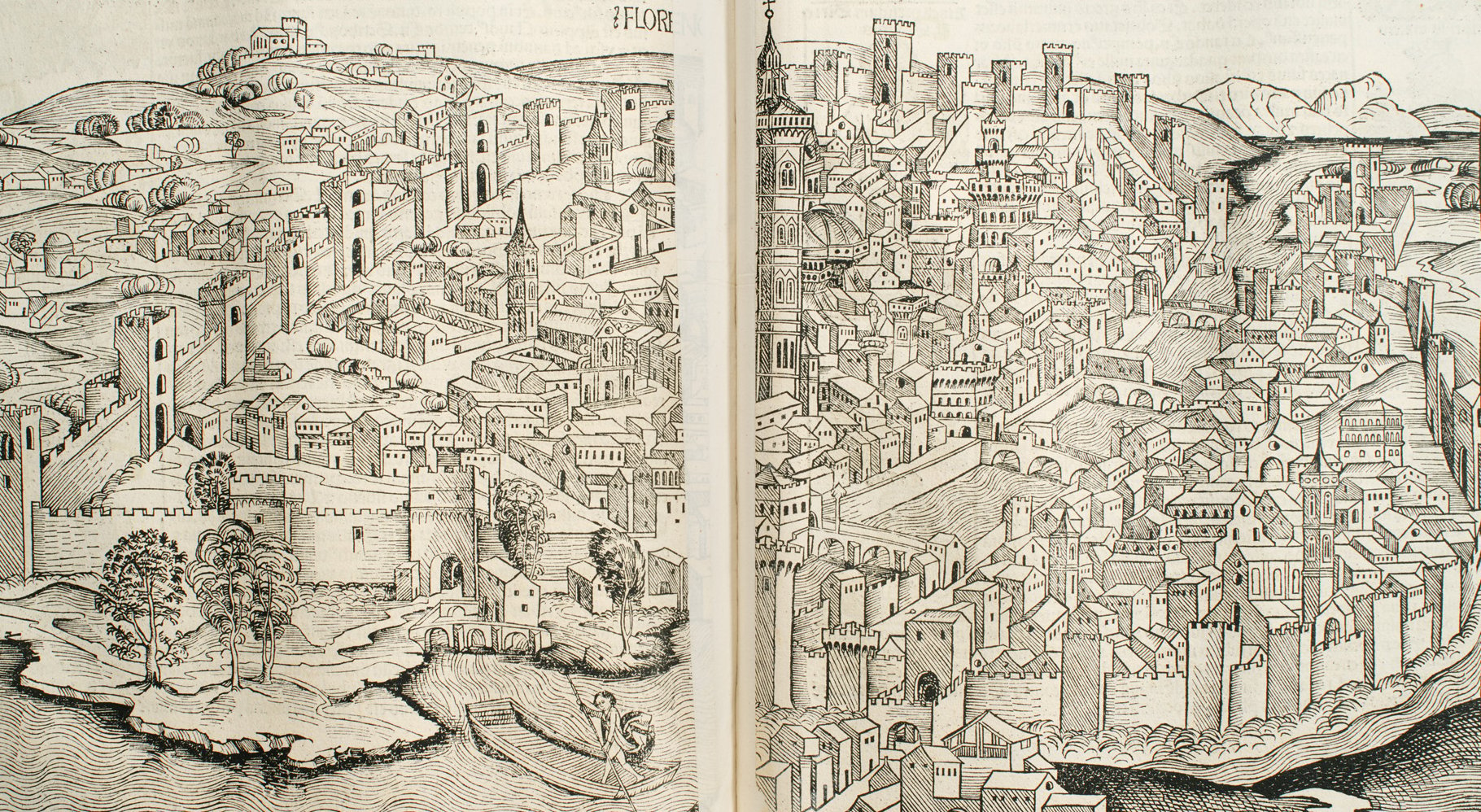 Hartmann Schedel (German, 1440–1514), View of Florence from Liber chronicarum (Nuremberg Chronicle) (Nuremberg: Anton Koberger, 1493). The Clark Library, NE1255 S35
In the sixteenth century, a vast consumer market emerged (largely in Europe) for images of cities, spurred by developments in print technology and new global exploration. Inquisitive consumers and armchair travelers were able to engage with distant places through travel books and world chronicles that offered information akin to traveling the world firsthand. Artists frequently copied maps, which often circulated widely as single-sheet prints, providing viewers with highly detailed visual information about places both near and far.
As public fascination with cities continued to grow, so did the interest of artists in depicting them. Comprising prints and photographs spanning almost five centuries, this exhibition examines representations of a variety of US and Western European cities to explore differing artists’ approaches. Some artists endeavored to offer objective records of a city’s defining monuments and topography. Others also attempted to capture a city’s character by including details such as figures or sites that represent larger socio-cultural ideas. Often, artists’ own relationships with the places they depicted influenced how they presented them to viewers.
Paper Cities is organized by the Clark Art Institute and curated by Allison Marino, curatorial assistant for works on paper.